Weather & Webcams for flying the San Francisco Bay Tour
compiled by Ganymed Stanek
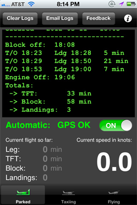
Flight Time Logger App for iPad and iPhone
Focus on flying instead of noting down take-off and landing times while you are in the cockpit.
Flight Time is automatically logging block off, take-off and landing times using GPS.
 .
. 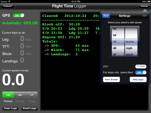
Get it for $6.99 in the Apple App Store

For iPad and iPhone 3GS, 4, 4S, 5 with iOS 5.0 or later
San Mateo Bridge

Skyline of downtown as seen from Sausalito
|
Berkeley
|


Remote controllable Golden Gate cam
Miramar Beach

Sam's Chowder House
Woodside
![]()
Santa Cruz Harbor


More Santa Cruz Harbor cams
Exploratorium Roof cam
More webcams
Mammothweather.com Cams:


Another cam in the Sierras: bishopweather.com

![]()


![]()


